
Homes Away from “Home”
Yisu Yang
2020
ArcGIS Map
English
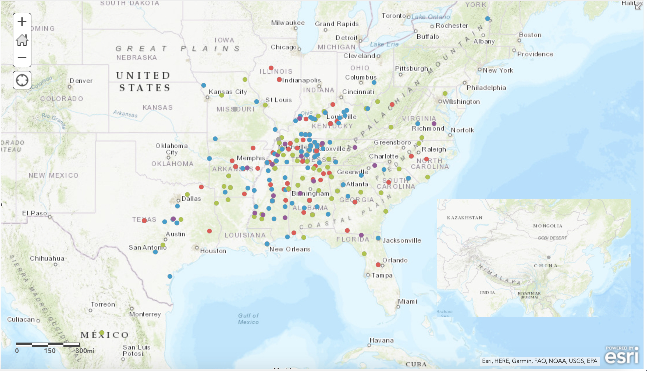
The map presented here draws student information from the 1875-1876 and 1877-1878 University Registers as well as the 1877 and 1878 Commencement Programs. A total of six hundred and eighty-nine data points are graphed by geographical location and categorized by the school that the student was associated with, showing also their respective courses, recognitions, etc.
There are five layers to the map that can be turned on and off to enable customized viewing. Years 1875, 1876, and 1877 each have their respective layer, displaying only the students that entered in that year. Years 1875 and 1877 are also clustered based on locations, showing the predominant school within a certain area.
The link to the Student Hometowns Map can be found here.
*Please note, this map will open in a new window in your browser.